wasserkarte
Gewässerstammbaum Deutschland
Every river, lake, canal and coastal water of Germany as a family tree — and the same tree on a map.
Jeder Bach mündet in einen Fluss, jeder Fluss in einen Strom, jeder Strom in ein Meer. This project records that lineage for 523 German waters, with three seas as the roots, and renders it as an interactive page and an A0 poster.
| Stammbaum | Karte | Mobil |
|---|---|---|
 |
 |
 |
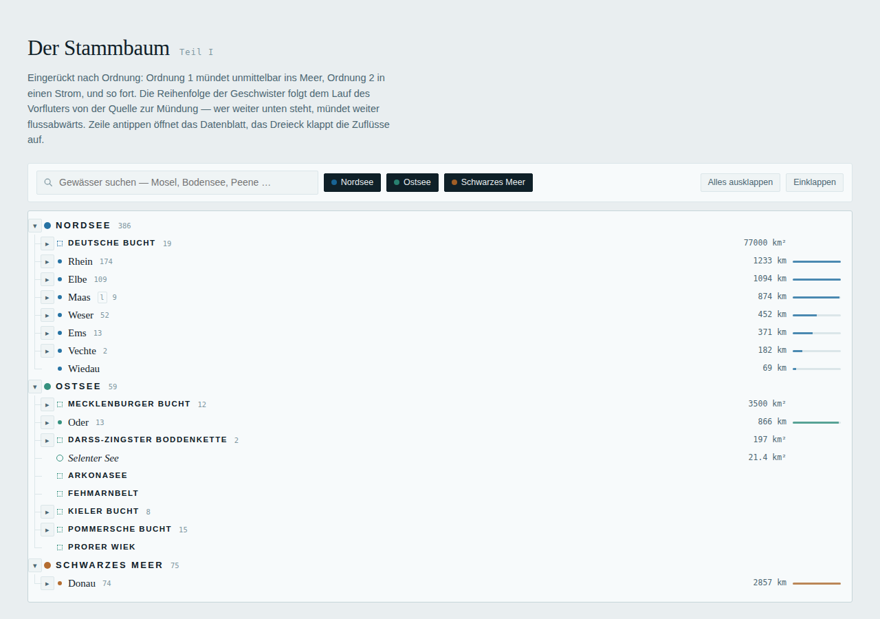
- Tree — indented by order (1 = drains into the sea), siblings sorted by where they enter the parent from source to mouth, searchable, filterable by sea.
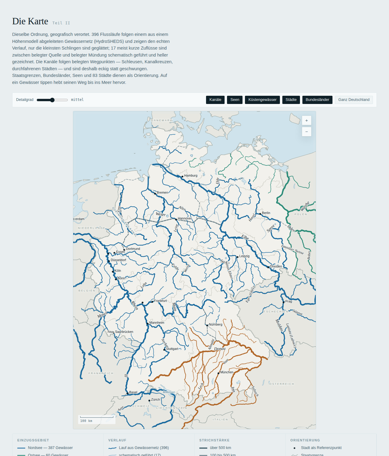
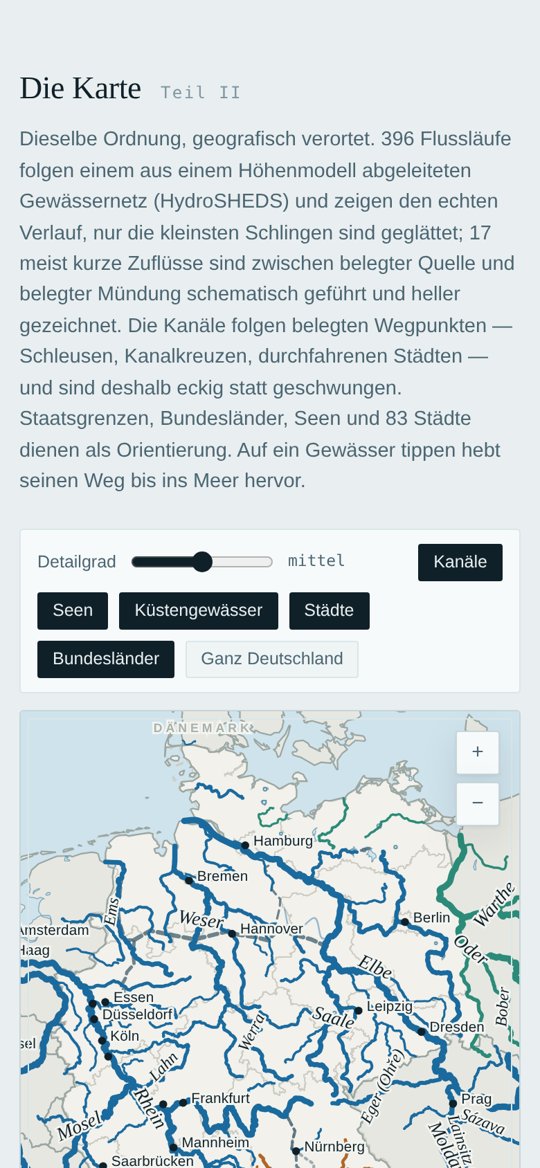
- Map — about 390 of 413 rivers follow the HydroSHEDS/HydroRIVERS river network; the few it cannot match come from GSHHG/Natural Earth or are drawn schematically and visibly lighter. Canals follow documented waypoints; borders, lakes and cities give orientation. Tap a water to highlight its path to the sea.
- Data — one JSON record per water with length, mouth, bank, states and a one-line fact, checked against the German Wikipedia. Also exported as CSV.
- Poster — the whole tree and the map on one A0 sheet (vector PDF).
The page is a single self-contained HTML file with no dependencies, in German, light and dark mode.
Quick start
git clone https://github.com/aboutali/wasserkarte.git
cd wasserkarte
make site        # -> dist/index.html (Python 3.10+, standard library only)
make serve       # http://localhost:8000
Tests, poster and screenshots use a headless browser:
npm ci && npx playwright install chromium
make smoke       # browser test of the page
make poster      # -> dist/gewaesserstammbaum-a0.pdf
Rebuilding the geometry from the raw sources (optional, ~1 min plus downloads):
pip install -r requirements-geo.txt
make geo         # fetch sources -> base layers -> trace rivers -> geometry
make help lists all targets.
How it works
data/waters/*.json  ─┐                                    ┌─► dist/index.html
data/geometry/*.json ─┼─► build_geometry ─► geometry.json ─┼─► dist/gewaesser.json, CSV
raw sources ─► prepare_base / trace_rivers ─► data/generated/ ┘  └─► build/poster.html ─► PDF
data/waters/is the source of truth: hand-edited records, one per line, grouped by river system. Schema and conventions: docs/DATA_MODEL.md.data/generated/holds pipeline outputs and is committed, so the site builds without the geo stack.- The map geometry comes from a priority chain — documented canal routes, courses traced in the HydroRIVERS (HydroSHEDS) river network, GSHHG and Natural Earth as fallbacks, and a schematic last resort. Details and the tracing algorithm: docs/PIPELINE.md.
Contributing
- Edit or add records in
data/waters/(any file;make fixmoves them where they belong). make check— must report 0 errors.make geometryif you changed coordinates, parents or routes; commitdata/generated/geometry.json.make site smokeand look at the page.
CI validates the data, checks that the committed geometry is current, builds the site and runs the
browser test. Pushes to main deploy dist/ to GitHub Pages (enable Settings → Pages → Source:
GitHub Actions once).
Working with Claude Code: CLAUDE.md describes the conventions and verification steps;
/add-water <name> and /check-map <id> are project commands in .claude/commands/.
Licence and sources
Code: MIT. Data: CC BY 4.0 for the curated records; river geometry from HydroRIVERS/HydroSHEDS (licence agreement, citation in DATA_SOURCES.md) with GSHHG (LGPL) as fallback, base layers from Natural Earth (public domain), state borders via deutschlandGeoJSON. See DATA_SOURCES.md for attribution and caveats.